drone photogrammetry
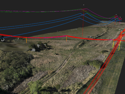
Geospatial Survey to Support Transmission Line Design
Topographic and detail survey over proposed electricity transmission alignment for engineering design….
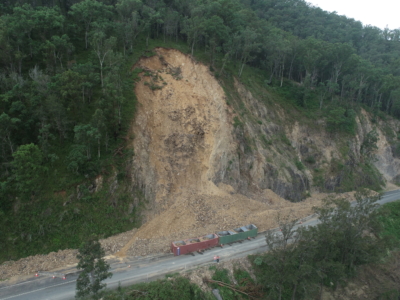
Multiple Landslide surveys
Combining drone lidar, photogrammetry and terrestrial laser scanning of multiple landslip sites…
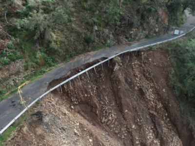
Geospatial Survey of Roadway Landslide
Using Drone Lidar and photogrammetry to inform geotechnical Risk assessment and design…