Geotechnical Survey
As Australia’s leading and most trusted provider of geotechnical survey solutions, Diospatial utilises a range of reality capture tools to ensure geotechnical engineers are given a robust data set that they can rely on to complete their geotechnical assessment.
Diospatial’s founder and CEO, Zack Wasson, is a trained geotechnical engineer. When he founded Diospatial he was working in the remediation of geotechnical hazards and identified the need to provide more accurate and complete information of the site conditions. Utilising drone survey, photogrammetry modelling, inspection and other reality capture tools, Diospatial was born to support the needs of geotechnical engineers.
What is a Geotechnical Survey?
Whether a geotechnical risk is being monitored or actively mitigated, geotechnical engineers need a reliable geotechnical survey that includes, but is not limited to, detailed terrain modelling, site visualisation and often and understanding of how the site is changing over time. All of this information allows geotechnical engineers to make an assessment of how best to manage the risk that is present.
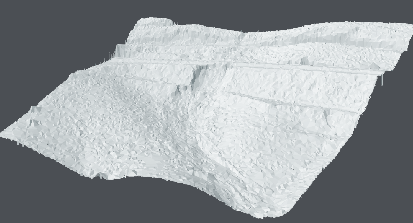
Diospatial captures and produces high detail spatial data that enables geotechnical engineers to complete a thorough risk assessment and support engineering design and planning. Using a combination of drone LiDAR, photogrammetry, laser scanning and more, Diospatial has the ability to filter vegetation to create detailed terrain models, produce high quality photo realistic visualisations, and generate survey grade 2D and 3D models.
the benefits of diospatial’s geotechnical survey
Diospatial has over 9 years providing geotechnical survey support to Australia’s largest infrastructure and asset owners. We know that reliable and accurate spatial data is important.
Founded by a geotechnical engineer, we understand the detail and information that is required to complete a geotechnical assessment and design of remediation works.
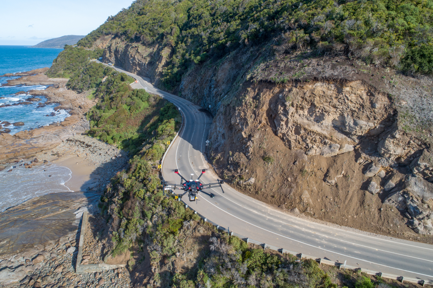
Our use of drones allows us to access hard to reach and often dangerous areas, providing detail and close visualisation of the site without putting people in the danger zone or requiring rope access.
We are available to support urgent geotechnical survey services when time is of the essence, minimising road, rail and asset closures.
Our hosting solution allows all project stakeholders to view and access the spatial data available, without the need for specialist software or powerful computing. This provides easy visualisation of all spatial data and sharing among project stakeholders.


Diospatial’s geotechnical survey solution
Diospatial’s geotechnical survey solutions support geotechnical engineers at multiple stages in the geotechnical workflow:
1. initial site investigation
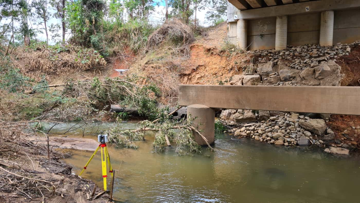
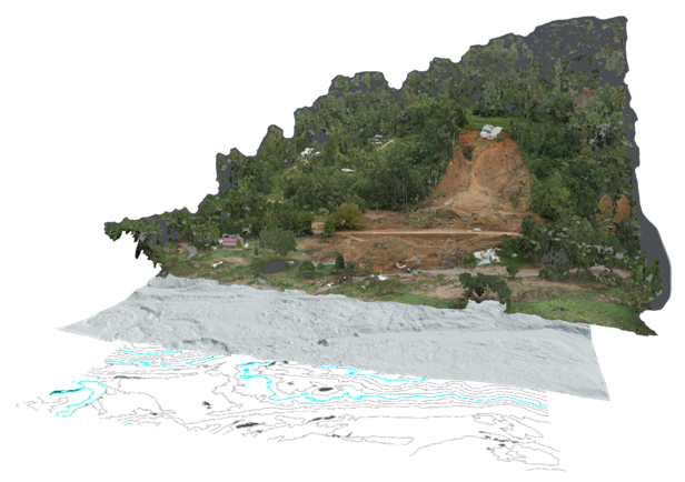
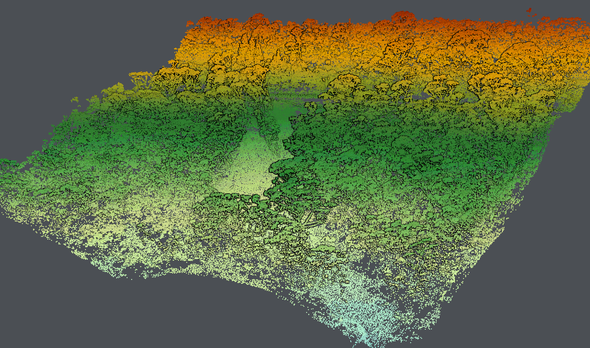
The starting point for most geotechnical risk assessments is understanding the terrain and identifying any movement that has occurred. Using drone LiDAR, Diospatial captures the survey area to produce a LiDAR point cloud. The point cloud is then classified to filter out vegetation and produce accurate terrain data, including digital terrain models (DTM), digital surface models (DSM) and elevation contours.
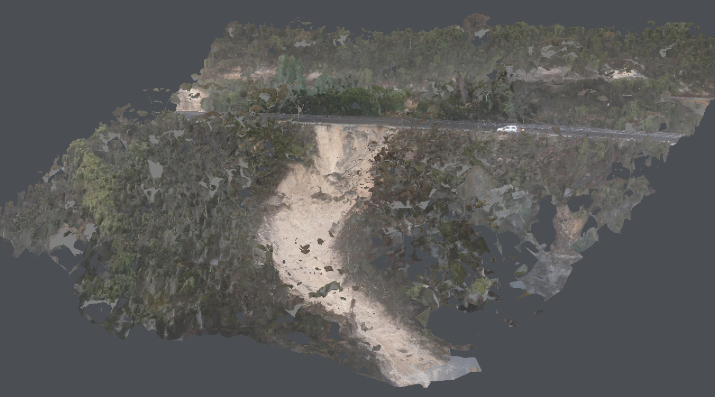
To provide context to the site conditions, visualisation is important, in particular, visualisation of areas that are hard to access in person. For this, Diospatial captures high resolution imagery using a combination of drone and hand-held capture techniques, which is then processed in photogrammetry software to produce a high quality photorealistic 3D model and orthophoto of the site. The 3D model is interactive and enables close visual inspection without the need to visit site. The orthophoto provides a birds-eye 2D view of the site which is layered with elevation contours.
The spatial data captured by drone LiDAR and photogrammetry can then be used to complete further geospatial analysis including watershed analysis, volume measurements and feature extraction.
Conventional ground survey is used to capture site features and produce an accurate survey which can then be used to support design and planning of remediation works.
Additional spatial data can also be captured and produced to better understand the site specific conditions, including detailed inspection, movement monitoring, overhang mapping, and more.
2. Change detection & Monitoring
To understand how a geotechnical site is changing over time, change detection and monitoring solutions can provide detailed information of the extent of changes that are occurring in an identified geotechnical risk site.
There are two main ways that this can be achieved.
- Ongoing monitoring using tilt sensors – set up in specific locations, these monitors provide real-time alerts of any movement that is detected.
- Multiple repeat data captures – these can be completed over set intervals and compared to each other to better understand the extent of any movement and any risk that is present.
Once multiple captures of the site are available, displacement analysis can be completed to understand how much of the earth has been displaced. This can provide important information to geotechnical engineers as they plan and design remediation works.

3. Work-as-executed Survey post remediation works
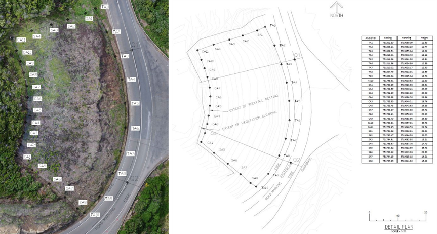
Once any geotechnical slope stabilisation works are completed, a detailed Work-As-Executed survey can be completed. This provides a digital copy of the most current condition of the site or asset for owners and operators to keep as a record, and can act as a record for completion of remediation works by contractors.
Diospatial generates a digital twin of the site which is then used to digitise the constructed features of the site, including any rock fall netting, rock bolts, soil nails, retaining walls and existing asset features. The digitised features are then exported to drafting software where detailed WAE drawings are prepared.
Unlike conventional means, the survey and feature extraction is completed safely and efficiently in a virtual environment, reducing exposure of site personnel and reducing the disruption to asset operators.

APPLICATIONS OF geotechnical surveys
Diospatial’s geotechnical survey solutions can be used for a range of geotechnical engineering challenges, including:
- Risk assessment
- Geotechnical remediation design
- Geotechnical risk monitoring
- Coastal erosion assessment and monitoring
- Overhang identification
- Drainage effectiveness and monitoring
- WAE documentation of remediation works
DEliverables of Geotechnical surveys
Our team of expert data technicians develop a reporting solution that provides engineers and asset owners with the most insightful and actionable deliverables.
Depending on the information required for the specific risks associated with the site, several different deliverables can be produced. This may include, but is not limited to:
- Topographic survey, including digital terrain model (DTM) and digital surface model (DSM), elevation contours, watershed analysis
- 3D photogrammetry modelling digital twin
- Conventional survey with extracted features
- High resolution imagery
- Point cloud
- Orthophoto
- WAE PDF Drawings
- Live monitoring portal
- Volumetric analysis
- Change detection heat map
- Web based 3D model hosted on Pointerra, with all geospatial data
QUALITY, EXPERIENCE AND TRUST IS WHAT SEPARATES DIOSPATIAL FROM EVERYONE ELSE
Our team is known for delivering the highest quality data and customer service in the industry. A relentless focus on quality control ensures we consistently meet or exceed project specifications. We understand client satisfaction requires client success, and our outcome-driven approach starts at scope development. We work with your team to ensure survey specifications and outputs are optimised to meet downstream user requirements and our support continues beyond delivery to ensure maximum utilisation of the data outputs.
Past Projects
Bathymetric and Topographic Survey
Hydrological and terrain modelling of river embankment and adjacent road to support…
Geotechnical Monitoring solution For High Risk …
monitoring of road corridor and associated high risk slopes to support on-going…
Geospatial Survey of Road Corridor
Drone LiDAR, photogrammetry modelling, terrestrial laser scanning and detail survey of road…
Aerial Survey of Council Lookout for Geotechnic…
Drone-LiDAR survey and 3D photogrammetry modelling of slopes and surrounding area of…
