Water
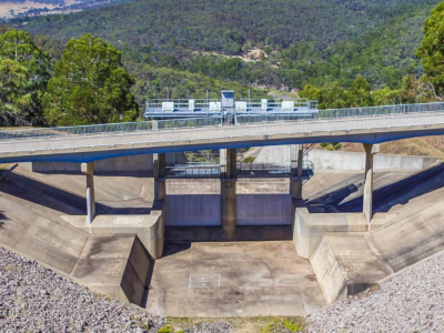
Change Detection of Dam Spillway
Drone LiDAR and photogrammetry survey of dam spillway after rain events to…

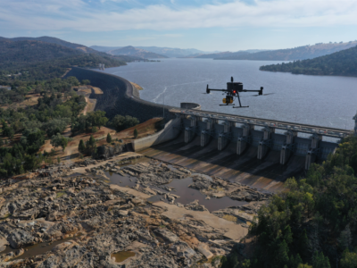
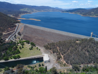
3D Survey & Digital twin of Dam & Water Infrastructure
Geospatial Survey of Dam & Infrastructure using Drone LiDAR, photogrammetry, laser scanning…
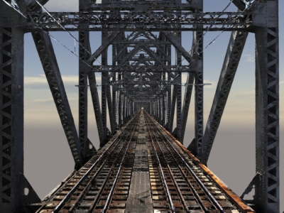
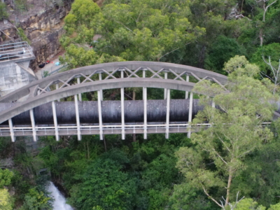
High Detail Digital Twin of Rail Bridge
High Detail Digital Twin of rail bridge to assist with the planning…
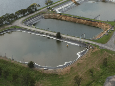
Water Treatment Plant Reservoir Survey and Modelling
Drone-Lidar and Photogrammetry survey of water treatment plant reservoir for condition assessment…
Complete Spatial Survey Solution
Geospatial survey solution combining drone lidar, photogrammetry, laser scanning and multi-beam sonar…
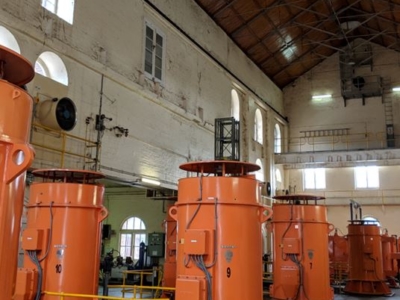
Pumping Station Reality Capture using Laser Scanning
Confined space Terrestrial Laser Scanning of sub-terranean pump wells for engineering design…
Photogrammetry and Imaging derived 3D Model for Spillway Bridge Inspection
Close visual inspection and 3D modelling of Spillway Bridge PROJECT OVERVIEW In…
Bridge Inspection and LiDAR derived Geotechnical Assessment of Abutments
Close visual Bridge inspection and LiDAR survey for geotechnical assessment of abutments…
Inspection, Survey and Defect Mapping of Dam using Photogrammetry, Thermal IR and Imaging
High resolution inspection and defect mapping over more than 60,000m2 of concrete…
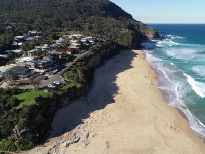
Coastal Erosion
A reasearch and development project utilising drone LiDAR and Photogrammetry for coastal…
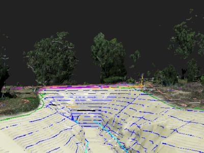
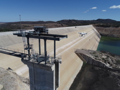
Dam Defect Mapping
Drone-based inspection, digital defect mapping and precision aerial survey for one of…
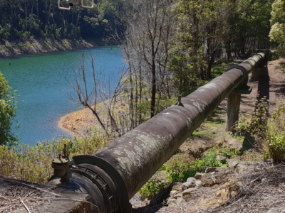
Inspection of water supply pipeline
High detail Reality Capture over 5km of water supply pipeline using drone…