Geospatial
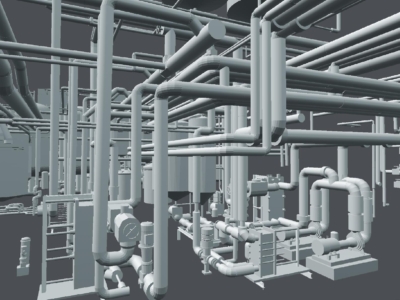
REVIT Modelling of Factory Pipes
High accuracy terrestrial laser scanning survey and scan-to-Revit modelling of ammonia piping…
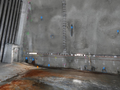
Tunnel Dilapidation Survey
defect mapping of tunnel for pre-construction dilapidation survey using photogrammetry modelling and…
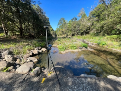
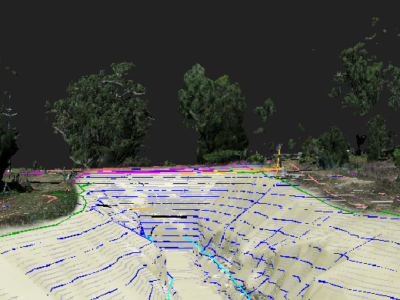
Survey Solution for Flood Recovery Works
Drone LiDAR, orthophoto, conventional survey and services location of 37no. sites to…

3D Survey & Digital twin of Dam & Water Infrastructure
Geospatial Survey of Dam & Infrastructure using Drone LiDAR, photogrammetry, laser scanning…
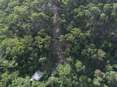
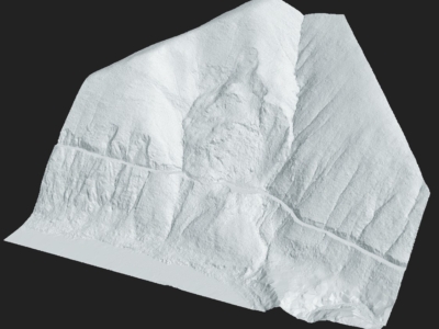
Geospatial Survey for Geotechnical Assessment
Drone LiDAR, photogrammetry modelling and geospatial analysis of rockfall and landslide to…
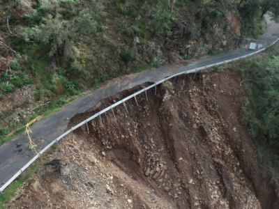
Drone Survey for Landslip Assessment
Drone LiDAR and photogrammetry survey of landslip area to identify extent of…
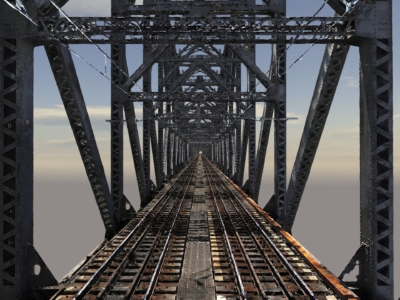
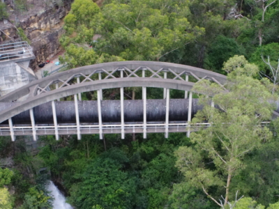
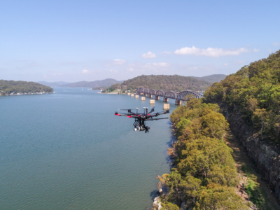
High Detail Digital Twin of Rail Bridge
High Detail Digital Twin of rail bridge to assist with the planning…

Spatial Source Leaders Forum: Interview with our Founder
At the end of 2022 diospatial’s founder, Zack Wasson, was interviewed as…
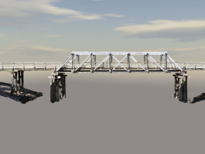
Photogrammetry Modelling of a Bridge
High detail photogrammetry modelling of a bridge for heritage archives. PROJECT OVERVIEW…
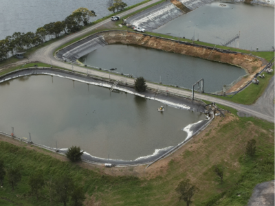
Water Treatment Plant Reservoir Survey and Modelling
Drone-Lidar and Photogrammetry survey of water treatment plant reservoir for condition assessment…
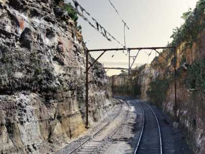
As-Built Survey of Rail Corridor for Engineering Design
High resolution drone LiDAR, photogrammetry and as-built survey of rail corridor for…
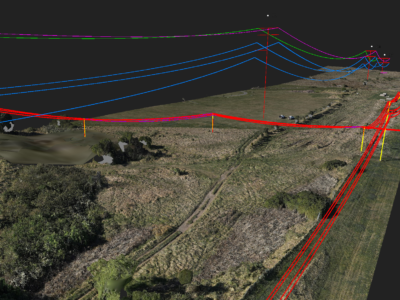
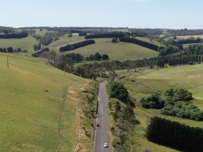
Geospatial Survey to Support Transmission Line Design
Topographic and detail survey over proposed electricity transmission alignment for engineering design….
Multiple Landslide surveys
Combining drone lidar, photogrammetry and terrestrial laser scanning of multiple landslip sites…
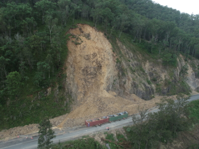
Geospatial Survey of Roadway Landslide
Using Drone Lidar and photogrammetry to inform geotechnical Risk assessment and design…
Complete Spatial Survey Solution
Geospatial survey solution combining drone lidar, photogrammetry, laser scanning and multi-beam sonar…
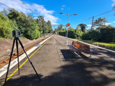
As-Built Survey of Train Station
Terrestrial laser scanning survey to produce as-built survey of train station for…
Slope Drainage Monitoring and Watershed Analysis
LiDAR and geospatial analysis of rail corridor slopes for inspection and monitoring…
LiDAR Survey of Roadside Cuts and Slopes for Stabilisation Designs
Drone-LiDAR derived topographic survey and photogrammetry modelling for slope stabilisation designs PROJECT…
Bridge Inspection and LiDAR derived Geotechnical Assessment of Abutments
Close visual Bridge inspection and LiDAR survey for geotechnical assessment of abutments…
Reality Capture using Photogrammetry for Slope Stabilisation works
Reality capture and Digital survey for slope stabilisation Works As Executed drawings…
Photogrammetry derived Reality Capture for Boardwalk Design and Geotechnical Assessment
High resolution drone LiDAR survey and Photogrammetry modelling for design of elevated…
LiDAR Survey and Reality Model for Geotechnical Assessment of hillside
High resolution drone LiDAR survey and 3D reality modelling to inform geotechnical…
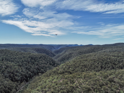
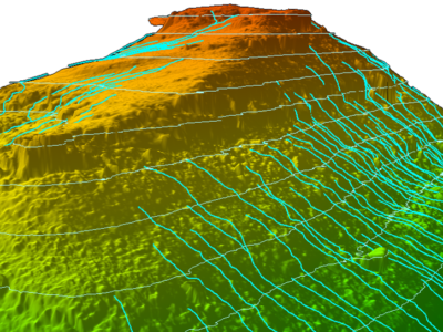
Geo-Hazard Mapping and Slope Risk Assessment
High resolution Drone-LiDAR survey for slope risk assessment of remote and densely…
LiDAR Survey for Geotechnical Assessment
High resolution Drone LiDAR survey of Illawarra Escarpment for geotechnical assessment and…
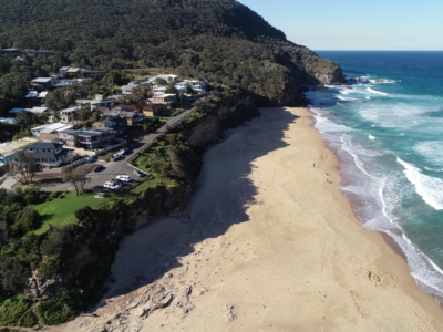
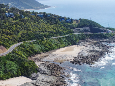
Coastal Erosion
A reasearch and development project utilising drone LiDAR and Photogrammetry for coastal…
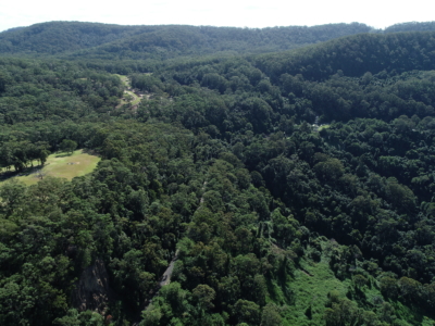
Rail Corridor Drainage Mapping
Drone LiDAR survey through dense vegetation to identify and Complete surface drainage…