Geotechnical Monitoring solution For High Risk slopes
monitoring of road corridor and associated high risk slopes to support on-going management and risk assessment.
PROJECT OVERVIEW
A road embankment failed due to heavy rainfall events. The asset managers engaged engineers to assess the geotechnical risk and landslide and develop a management plan. Diospatial was engaged to provide a geotechnical monitoring solution using geospatial data to support ongoing geotechnical assessments and monitoring of the road and adjacent slopes.
Project Scope
DIOSPATIAL SOLUTION
Diospatial developed a geospatial survey solution that utilized multiple reality capture technologies including drone survey, photogrammetry modelling, ground-based survey, tilt sensors and pipe crawler inspection vehicles. The combination of these reality capture technologies provided consulting engineers with a detailed understanding of the condition of the site and an ongoing geotechnical monitoring solution for real-time updates.
When real-time sensor alerts are received, consulting engineers can consult the corresponding weather data and geospatial survey to understand the significance and extent of any movement, improving the utilisation of resources.
GEOSPATIAL SURVEY
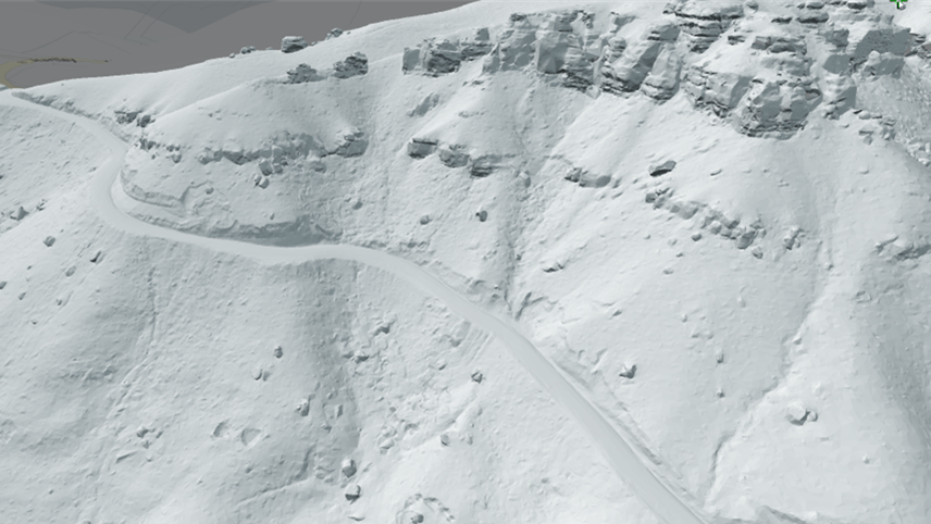
Drone LiDAR survey was used to capture the bare earth terrain beneath the vegetation to understand the topography and extent of the road embankment failure.
Photogrammetry modelling was used to provide 3D visualisation of the site conditions and identification of any further geotechnical hazards.
A survey network was established with survey nails and pegs installed at various locations along the road corridor to support periodic survey monitoring and manual taped measurements of point to point distances.
REAL-TIME TILT SENSORS
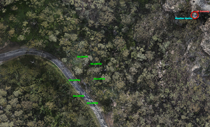
High precision tilt sensors were installed on nominated geotechnical hazards to provide continuous and real-time geotechnical monitoring of the site. Communicating with an on-site 4G Gateway, any movement at the tilt sensors is detected and communicated back to a web-based platform. Movements in any direction within a nominated amount trigger an alert to all project stakeholders.
WEATHER MONITORING
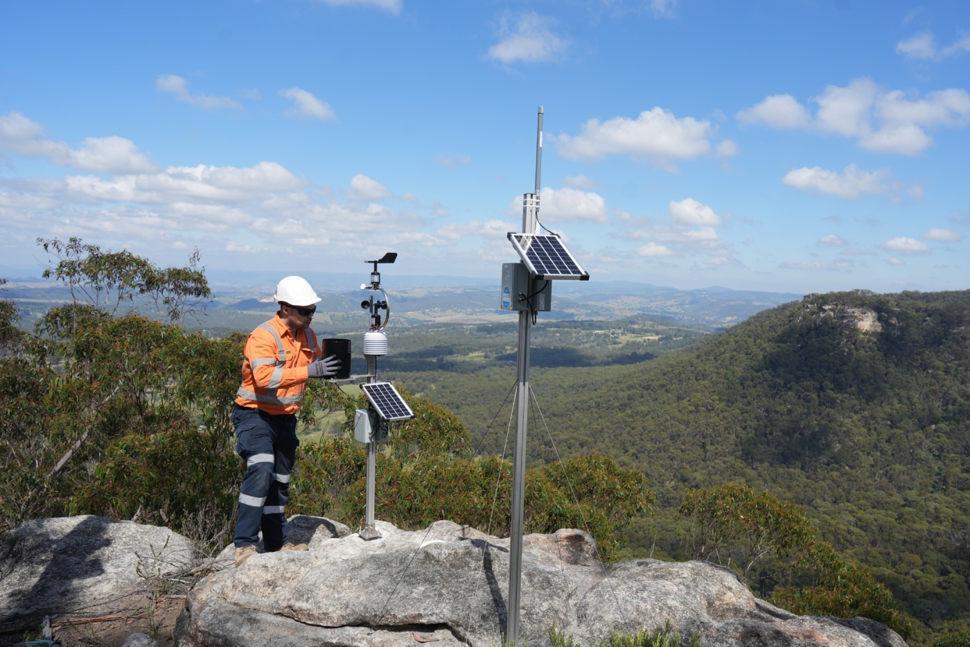
A weather station was installed on the top of the escarpment to provide real-time weather data to provide more accurate site condition information. Just like the tilt sensors, the weather station was connected with an onsite 4G Gateway to provide real-time data.
The weather station provides consulting engineers with accurate weather data that is specific to the site and time periods measured by the tilt sensors. This allows consulting engineers to provide a more robust assessment when any movement is detected.
CULVERT INSPECTIONS
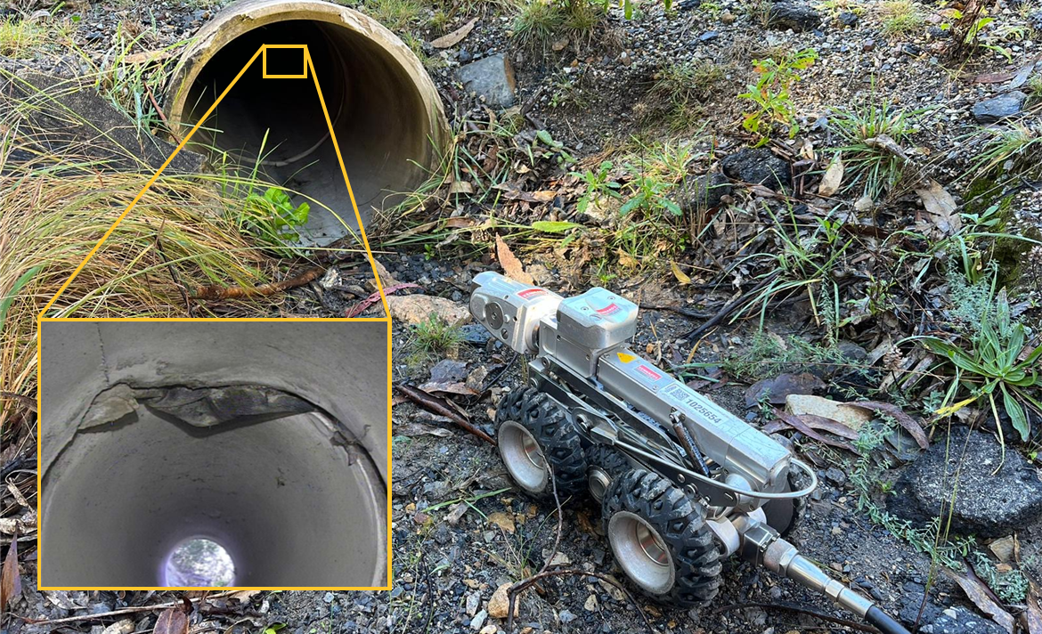
Finally, inspection of culverts was completed using pipe crawlers to visually inspect the condition and structural integrity of culverts and understand the hydraulic performance of the culverts as an important part of geotechnical monitoring and management of the road infrastructure.
This complete spatial solution provided the asset managers and consulting engineers with a robust understanding of the current site conditions and a reliable geotechnical monitoring solution for the high risk site. The combination of all geospatial data allows consulting engineers to more accurately assess the significance and extent of any movement on the embankment, improving the utilisation and responsiveness of ground stabilisation resources.


